Hiking the Foothills Trail in Oconee County
Hiking the Foothills Trail in Oconee County
The Foothills Trail is one of the most scenic and rewarding long-distance hikes in the Southeast. Spanning approximately 77 miles from Oconee State Park to Table Rock State Park, this trail traverses the stunning Blue Ridge Escarpment, providing hikers with breathtaking waterfalls, dense forests, and diverse wildlife. Oconee County marks the southwestern terminus of the trail, making it a prime starting point for adventurers. Whether tackling the full trail or exploring shorter sections, hikers will find a well-maintained path with captivating scenery and challenging terrain.
Adventure Guide to Hiking the Foothills Trail
Oconee State Park to Chattooga River Section
- Location: Trailhead at Oconee State Park, SC
- Why It’s Special: This 14.2-mile section features gentle inclines, hardwood forests, and scenic river crossings. It passes through the historic Chattooga River corridor, known for its outstanding natural beauty.
- Key Features: Trail shelters, accessible water sources, and well-marked paths.
Laurel Fork Falls
- Location: Accessible via a side trail near mile 30
- Why It’s Special: This 80-foot cascading waterfall tumbles into Lake Jocassee, creating a picturesque setting for a rest stop.
- Key Features: The hike to the falls is relatively moderate, making it a popular camping and photography spot.
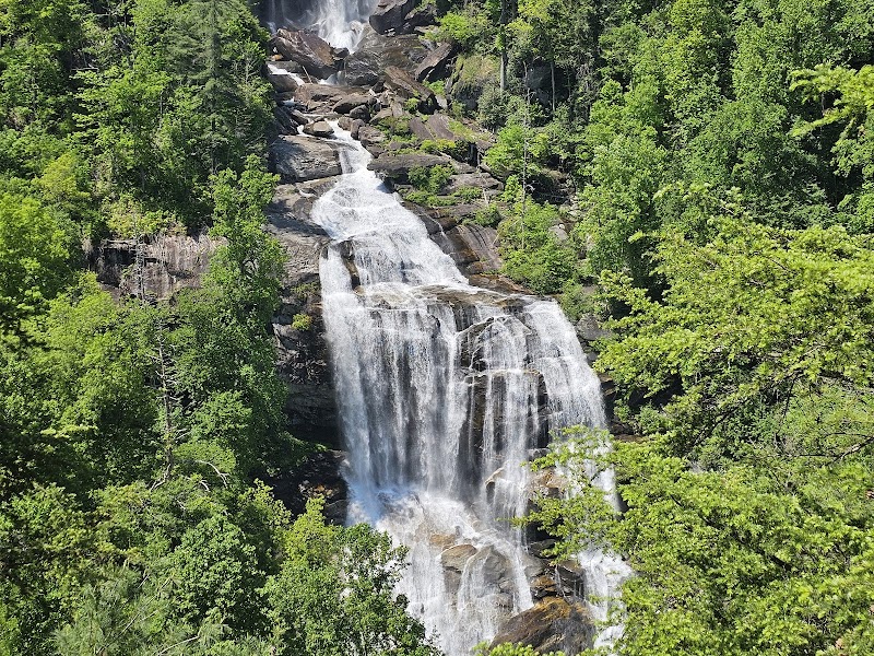
Whitewater Falls Overlook
- Location: Built-in overlook near mile 35
- Why It’s Special: Offers a panoramic view of Whitewater Falls, the highest waterfall in the eastern U.S., at 411 feet.
- Key Features: Benches, scenic rest stop, and fantastic photo opportunities.
Local Insights
- The Foothills Trail was completed in the 1980s and is maintained by the Foothills Trail Conservancy.
- Wildlife includes black bears, white-tailed deer, and wild turkeys—always store food properly when camping.
- The trail frequently crosses the North Carolina-South Carolina border, offering diverse landscapes.
Visitor Tips
- Best Time to Visit: Spring and fall offer cooler temperatures and vivid foliage. Summers can be hot and humid.
- What to Bring: Sturdy hiking boots, plenty of water, bug spray, and a detailed trail map.
- Driving Directions: Oconee State Park is a 15-minute drive west of Walhalla, SC, via Highway 107.
Adventure Map
Reviews
caroline milburn3 months ago
Creation is breathtaking!! Five stars!!
Trailwise .. it's about 6 miles and some change. Most of the blazes are easy to spot.
Once you get about .6 miles to the upper falls part, the trail marks are harder to see. We had to ask people for directions if the trail did continue.
Pat Speake6 years ago
Great hike. Two hours total to the falls and back with 2 dogs and my wife in tow. 12,000 moderate steps. Well marked trail. Beautiful 200 foot waterfall. Nice views along the way. Very few people on the trail on a beautiful April Friday morning. An Oconee county gem- check it out!
Jason6 years ago
The hike to the falls is nice and relatively easy. The trail distance online is off from what the signs say. It took us a little over 2.5 hours to do the hike with three kids. It can be a little slippery so watch your step.
RBryant Swift-Tek7 years ago
Beautiful scenery! Get outdoors and enjoy. Fairly hilly trial to get to the lower fall view point.
Trevor Setzera year ago
Beautiful creation the Lord has made! Enjoyed swimming in the cool river and letting the waterfall wash the grime and sweat off from the long hike.