Hiking the Torreya Trail in Torreya State Park
Hiking the Torreya Trail in Torreya State Park
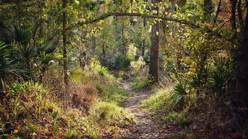
Torreya State Park, located in Florida’s Panhandle, is home to the Torreya Trail, a challenging and rewarding hike known for its steep terrain, diverse ecosystems, and historic significance. Unlike many trails in Florida, this route features elevation changes that provide stunning panoramic views of the Apalachicola River. The unique geography makes it one of the most rugged and scenic hiking experiences in the region.
Adventure Guide to Hiking the Torreya Trail
-
Torreya Trail Overview
The Torreya Trail is an approximately 6.5-mile loop featuring a mix of hardwood forests, ravines, and high bluffs that overlook the river below. The terrain is more demanding than typical Florida hikes, with significant inclines and descents. This trail is ideal for experienced hikers seeking a moderate to strenuous workout with rewarding sights, including rare Florida Torreya trees. -
Scenic Highlights Along the Trail
- The Apalachicola River Bluff Overlook offers a breathtaking vista of the river valley, particularly stunning during sunrise or sunset.
- The Gregory House, a historic plantation-era home, rests along the route, providing insight into the region’s past.
- Towering steephead ravines create a cool, shaded environment that supports unique plant life not commonly found elsewhere in the state.
-
Wildlife and Natural Features
The combination of dense hardwood forests and riverfront habitats means you're likely to encounter white-tailed deer, gopher tortoises, and migratory birds like woodpeckers and hawks. The Florida Torreya tree, one of the rarest conifers in North America, is unique to this area and adds to the trail’s ecological significance.
Visitor Tips
- Best Time to Visit: Cooler months (October to April) provide the most comfortable conditions, as summer temperatures can be hot and humid.
- What to Bring: Sturdy hiking boots with good traction, water (at least 2 liters per person), insect repellent, and a packed lunch for enjoying the scenic rest areas.
- Driving Directions: Torreya State Park is located about 40 miles west of Tallahassee. Take I-10 west to Exit 166, follow FL-12 west for 3 miles, then head south on CR-271 to the park entrance.
Reviews