Hiking the Tosohatchee Wildlife Area Trails in Orlando
Hiking the Tosohatchee Wildlife Area Trails in Orlando
The Tosohatchee Wildlife Management Area (WMA), located just outside Orlando, offers a serene retreat into Florida’s natural beauty with over 60 miles of trails designed for hiking enthusiasts. These trails wind through diverse ecosystems, giving visitors a glimpse of swamps, pine forests, and open pastures. This area is a must-visit for those who love spotting wildlife, exploring historic sites, and immersing in Florida’s native landscapes.
Adventure Guide To Hiking the Tosohatchee Wildlife Area Trails
-
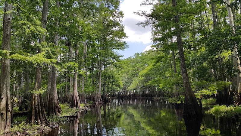
Turkey Creek Loop Trail
- Location: Accessible from the Tosohatchee WMA main entrance off Taylor Creek Road.
- What Makes It Special: This 8.3-mile trail provides a moderately challenging hike through wetlands and cypress domes. The route passes Turkey Creek, a pristine waterway where spotting alligators and wading birds is common.
- Key Features or Amenities: Marked trails, primitive restrooms, and designated parking areas near the entrance.
-
Beehead Ranch Trail
- Location: Located in the southwest quadrant of the WMA.
- What Makes It Special: This historical route leads hikers to remnants of an old ranch. It’s a shorter trail (around 3.5 miles), ideal for casual hiking and photography. The combination of towering pines and open fields makes it especially picturesque.
- Key Features or Amenities: Shaded stretches and informational signage about the ranch’s history.
-
Trail Around Jim Creek
- Location: Near Tosohatchee’s southeastern boundary.
- What Makes It Special: This 5-mile hike hugs the edges of Jim Creek, treating visitors to rich biodiversity, including deer, river otters, and a variety of bird species like woodpeckers and warblers.
- Key Features or Amenities: Several scenic spots suitable for picnics (carry out trash) and wildlife observation.
Local Insights
Tosohatchee WMA serves as a vital conservation area. Once used for cattle grazing, it was purchased by the state to restore and preserve Florida’s wetlands. Additionally, parts of the area feature remnants of historical logging operations from the early 20th century.
Visitor Tips
- Best Times to Visit: Late fall through early spring to avoid heat and mosquitoes.
- What to Bring: Comfortable hiking boots, plenty of water, sunscreen, insect repellent, and a camera for wildlife photography.
- Driving Directions: From Orlando, head east on FL-50. Turn right onto Taylor Creek Road, and the entrance is approximately 10 miles ahead (30-minute drive).
Adventure Map
Reviews